




Samuel Appiah Kubi · Geospatial Software Engineer

From Satellite Data
to Decisions.

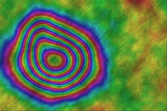
I build the software that sits between satellite archives and decisions — open-source Earth observation platforms, InSAR deformation pipelines and GeoAI models validated against field ground truth.

View My Work
Author & Maintainer · PyPI · Zenodo DOIs

Open-Source EO
Software, Built to Ship.

pygeofetch, pygeovision, pyunwrap and ps-gnn — CI-tested Python packages spanning 22 verified data providers, a full Sentinel-1 InSAR chain and 51 end-to-end GeoAI pipelines.

Explore the Code
Erasmus Mundus Scholar · Salzburg, Austria

Digital Earth.
From Accra to Salzburg.

Copernicus Master's in Digital Earth at Paris Lodron University of Salzburg and Student Assistant at Z_GIS — after a First Class Honours BSc in Geomatic Engineering at KNUST.

Get In Touch
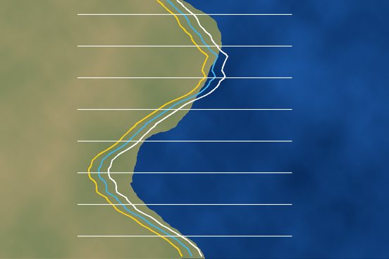
Slide 1: From satellite data to decisions
Slide 2: Open-source EO software
Slide 3: Digital Earth

Geospatial software engineer and Earth observation researcher. I document limitations as carefully as results.

I work daily in Python with GDAL, Rasterio, PyTorch, Docker and PostgreSQL/PostGIS — building open-source EO platforms, Django/PostGIS and FastAPI backends for flood early warning and site screening, and GeoAI models for crop mapping, mining detection and deformation monitoring, validated with spatial cross-validation and field ground truth.

  • KNUST First Class Honours
  • Erasmus Mundus Copernicus Digital Earth
  • Amazon Web Services Solutions Architect – Pro
  • IEEE T-ITS Manuscript Submitted

What I do

Six disciplines I combine to take a question from a bounding box and a date range to a validated, deployed answer. Open any of them to see exactly what I deliver and how I approach the problem.

  • SAR & InSAR

    Sentinel-1 SLC processing, burst coregistration with ESD, SNAPHU unwrapping, SBAS time series and ERA5 / IONEX atmospheric correction.

    Explore
  • Geospatial AI & Vision

    U-Net, Swin-UNETR, SegFormer, YOLOv8, GNNs and EO foundation models (Clay, Prithvi, DINOv3) — with spatial-block cross-validation.

    Explore
  • EO Data Engineering

    STAC 1.0, Cloud Optimized GeoTIFF, GeoParquet, PMTiles and OGC services; federated, checksum-verified access to 22 providers.

    Explore
  • Backend & Cloud

    Django, FastAPI, PostgreSQL / PostGIS, Redis, Celery, MQTT and WebSockets — shipped with Docker, AWS, GitHub Actions CI and PyPI.

    Explore
  • Applied EO Research

    Crop-type mapping, NDVI forecasting, forest-carbon and coastal-erosion digital twins, flood and deformation monitoring.

    Explore
  • Field Survey & Validation

    Total Station, GNSS and UAV photogrammetry, ground-control networks and participatory plot-level ground truth.

    Explore
Languages
  • Python
  • SQL
  • JavaScript (Earth Engine)
  • R
  • Bash
Geospatial
  • GDAL / OGR
  • Rasterio
  • GeoPandas
  • Xarray
  • Google Earth Engine
  • QGIS plugins
  • ArcGIS Pro
  • MapLibre
  • Leaflet
Machine learning
  • PyTorch
  • PyTorch Geometric
  • TensorFlow
  • scikit-learn
  • Optuna
  • ONNX
  • Domain adaptation
Data & sensors
  • Sentinel-1 / 2
  • Landsat
  • GEDI
  • SMAP
  • ERA5
  • CHIRPS
  • HiRISE / CTX (Mars)
  • UAV

Professional experience

Industry, NGO and research roles across Ghana and Austria — from mine surveying in the field to production AI in the cloud.

  • 2026
    Sep 2026 – Present · Salzburg, Austria

    Student Assistant — Geospatial Sustainability Compliance

    Z_GIS, Department of Geoinformatics, University of Salzburg

    Supporting research on sustainable change through geospatial innovation — physics-informed and geometric deep learning, cloud-native radar interferometry and agentic AI for multi-sensor EO workflows.

  • 2024
    Sep 2024 – Present · Accra, Ghana

    AI Research Engineer — Agricultural Remote Sensing

    Afarinick Company Limited

    Integrated mobile imagery, satellite NDVI/EVI time series and IoT ground sensors into a production monitoring system on AWS (EC2, S3). Diagnosed a crop-disease CNN that scored 95.8% in-domain but near-zero on smallholder farms, and fixed it with geographically stratified data and field re-validation.

  • 2024
    2024 · Accra, Ghana · Remote

    Geospatial Researcher — Satellite & Ground-Data Fusion

    Rainforest Alliance

    Built a hybrid monitoring system fusing Sentinel-2 (10 m) with participatory plot-level ground truth, running automated change detection over 333.9 km² of land and forest.

  • 2024
    2024 · Accra, Ghana

    Geospatial Data Engineer

    Ghana Export-Import Bank / SKTLive Ltd

    Engineered PostgreSQL/PostGIS spatial databases and Python/GDAL pipelines converting GeoTIFF aerial imagery into multi-scale tile pyramids for web map delivery.

  • 2023
    Oct – Nov 2023 · Manso-Nkwanta, Ghana

    Assistant Mine Surveyor (Intern)

    Asanko Gold Ghana Ltd

    Operated Total Stations, GNSS receivers and UAVs to establish ground-control points used to validate satellite- and drone-derived models.

OPEN-SOURCE SOFTWARE

All Repositories

BY THE NUMBERS

A few figures from the open-source platforms and field research above — each one traceable to code, data or a held-out evaluation.

  • Verified EO data providers

  • End-to-end GeoAI pipelines

  • Registered model architectures

  • km² under automated change detection

  • Valid interferograms, Mexico City

  • km of road validated (TRECK)

Flagship research

Two open-source GeoAI methods I designed for the hardest steps in radar interferometry, benchmarked against the classical methods they aim to improve.

Flagship research · Learned InSAR unwrapping

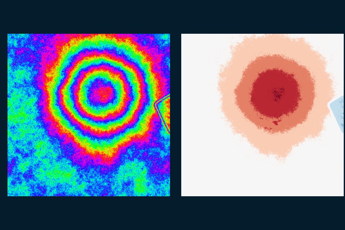
pyunwrap

AmbiguityNet predicts integer phase cycles, so its output re-wraps to the measured interferogram by construction

Phase unwrapping is where most InSAR errors are born. pyunwrap learns the integer cycle count rather than the phase itself, so every answer stays consistent with the radar measurement.

  • 99.1%Exact cycle count, easy test scenes
  • 96.6%Exact cycle count, moderate test scenes
  • 92.0%Full-scene skill, easy (oracle = 100)
Read the case study
Flagship research · Graph neural networks

PS-GNN

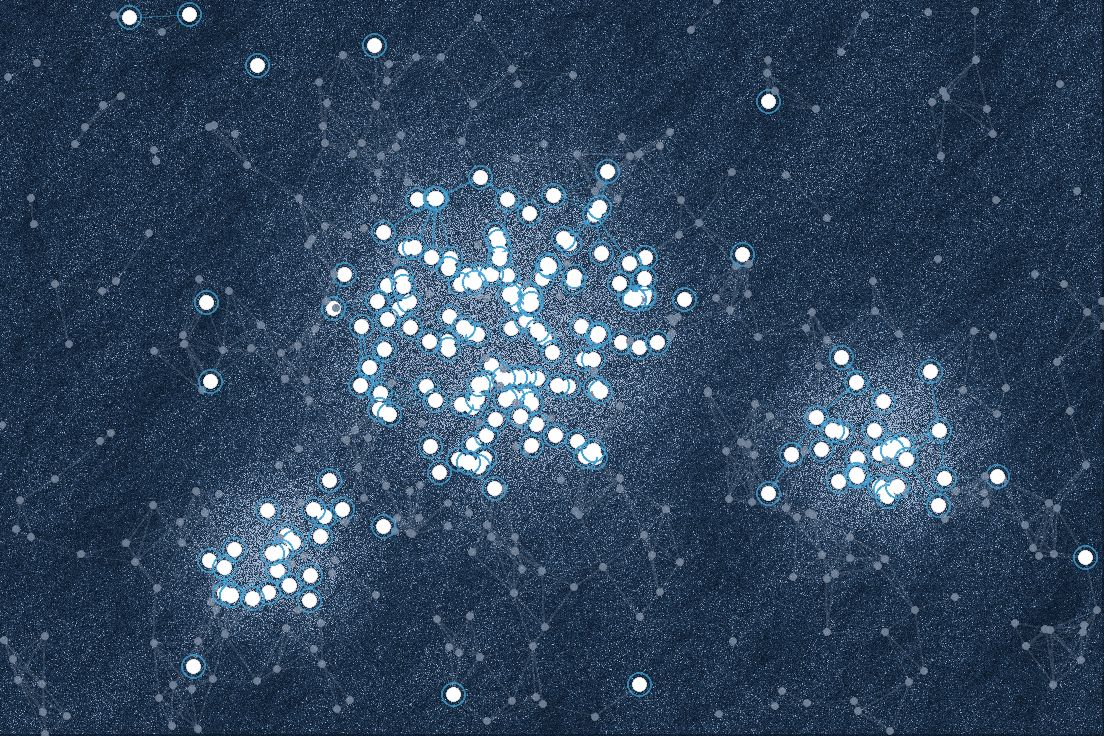
Each candidate radar pixel is judged together with its neighbours, not in isolation

Classical PS-InSAR picks stable radar targets one pixel at a time with fixed thresholds. PS-GNN looks at each pixel in the context of its neighbours, and on hard scenes it beats the StaMPS-style baseline on every metric.

  • 0.82 vs 0.69F1 on hard test scenes vs StaMPS-style
  • 0.97Borderline-PS recall on hard scenes (StaMPS-style 0.47)
  • 0.96F1 on easy test scenes
Read the case study

Selected projects

GeoAI first, then backend systems, InSAR and applied research. Open any project for its aim, approach, data, results and validation.

SAR–Optical FusionYOLOv8

Atewa Illegal Mining Detector

2026

Dual-stream U-Net + YOLOv8 fusing Sentinel-1 and Sentinel-2, trained on UAV-derived labels. Recall 82%, F1 0.79 on held-out tiles.

View case study
Foundation ModelsSentinel-2

Crop-Type Mapping with EO Foundation Models

2026

Clay fine-tuned on multi-temporal Sentinel-2 stacks for 10 m crop types, benchmarked against ResNet-50; F1 above 0.70 under spatial cross-validation.

View case study
UAVObject Detection

Cocoa Plant Detection & Counting

2026

YOLOv8 with multi-temporal analysis and ensemble uncertainty scoring to detect and count cocoa plants across smallholder and commercial layouts.

View case study
LSTMNDVI

Agricultural Digital Twin

2024 – Present

LSTM forecasting of 10 m Sentinel-2 NDVI from CHIRPS rainfall and ESA CCI soil moisture; R² above 0.50 and MAE below 0.07 at parcel level.

View case study
REDD+GNN

SMART-FOREST

2026 – Present

Fuses Sentinel-1/2, GEDI LiDAR, SMAP and ERA5 in object-based and temporal GNNs to forecast above-ground biomass over 10-year horizons under RCP scenarios.

View case study
Swin-UNETRShoreline

Coastal Erosion Digital Twin

2025 – Present

3-month shoreline forecasts (MAE below 8 m) from Sentinel-1/2, Landsat, UAV orthomosaics and wave climatology, validated against DSAS transects.

View case study
Sensor FusionIEEE T-ITS

Multi-Modal Road Assessment (TRECK)

Aug 2025 – Present

Camera / IMU / GPS fusion for metric-accurate road assessment, validated against 50 surveyed ground-truth measurements along 50 km of road.

View case study
BackendIoT + Satellite

Flood Watch Ghana

2025 – 2026

Django + PostGIS backend with MQTT ingestion from ESP32 gauges, Celery-scheduled Sentinel-1/2 flood detection and Twilio WhatsApp / SMS community alerts.

View case study
FastAPISite Screening

Fatal Flaw Geospatial Risk Platform

2025 – 2026

Screens Solar, Wind, BESS and data-centre sites against 15 authoritative constraint layers with fatal-flag detection, weighted risk scoring, PDF reports and a QGIS plugin.

View case study
InSARDigital Twin

Urban Subsidence Watcher

2026 – Present

Sentinel-1 from the ASF Vertex API through an SBAS chain, with a Tiny U-Net on an 8-channel stack exported to ONNX for edge deployment.

View case study
InSARCase Study

Mexico City Land Subsidence

pygeofetch case study

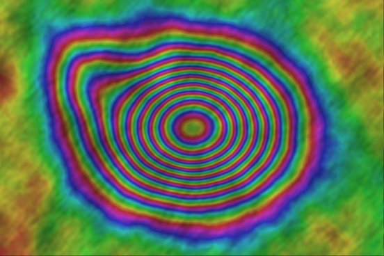
67 SLC scenes; 2,211 candidate pairs reduced to 78 valid interferograms; −35.5 to −2.9 cm/yr, consistent with the peer-reviewed −39.1 cm/yr peak.

View case study
LandsatTime Series

Obuasi Vegetation Decline

2018 – 2024

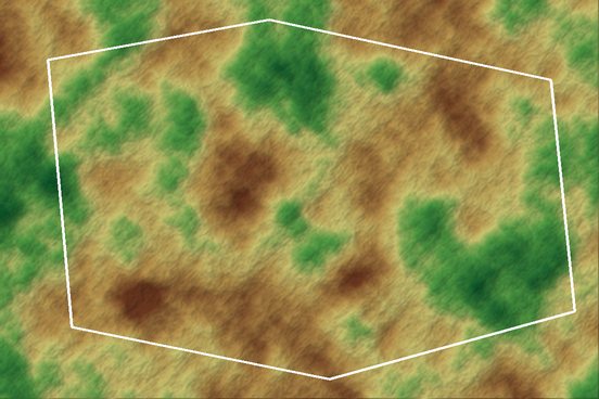
Boundary-clipped USGS Landsat NDVI trend: 32.0% of the district in measurable decline (9.2% strong, 22.8% moderate), concentrated around mining.

View case study

Ventures & affiliations

The organisations I've founded and the research groups I build with — from open EO education in Africa to radar research in Salzburg.

EOCoreINT logo

FOUNDED · EOCoreINT

Earth Observation Core Intelligence — “From Satellite Data to Decisions.”

An open-source EO software organisation and learning academy teaching applied remote sensing and GeoAI to African students and professionals with open tools. It is home to pygeofetch, ps-gnn, pyunwrap and the data-engineering toolkit, and its courses use genuine West African examples — White Volta vegetation, cocoa farms, Lake Volta shorelines and illegal mining in the Atewa range.

  • Course academy: category → course → module → lesson, with quizzes, progress and certificates
  • B2B / B2G consulting engine: quote → project → delivery → branded PDF invoice
  • Organisation workspaces with role-scoped access for government, NGO and enterprise clients
Visit eocoreint.com

RESEARCH AFFILIATIONS

The groups I research with, from radar in Salzburg to sensor fusion in Kumasi.

  • 2026 – Present · Salzburg, Austria

    Z_GIS, University of Salzburg

    Student Assistant, Geospatial Sustainability Compliance

    Supporting research on sustainable change through geospatial innovation: physics-informed and geometric deep learning, cloud-native radar interferometry and agentic AI for multi-sensor Earth observation.

  • 2024 – Present · Kumasi, Ghana

    Roadessy Lab, KNUST

    Member, Multi-Modal Sensor Fusion Research

    Road monitoring, asset management and inventory research in the Department of Geomatic Engineering, including the TRECK camera / IMU / GPS fusion project.

  • 2025 – 2026 · Columbia, Missouri, USA

    Deep Metrics Research

    Member, Computer Vision for Intelligent Transportation

    An AI research group developing computer vision and sensor-fusion methods for real-time traffic analytics and infrastructure assessment.

RESEARCH & PUBLICATIONS

  • Aug 2025 – Present · TRECK / Roadessy Lab, KNUST

    Principal Researcher — Multi-Modal Sensor Fusion for Road Assessment

    Led a five-component camera / IMU / GPS fusion architecture for metric-accurate road assessment, validated against 50 manually surveyed ground-truth measurements along 50 km of road. Manuscript submitted to IEEE Transactions on Intelligent Transportation Systems.

  • Software citation · Zenodo

    Appiah Kubi, S. pygeofetch: a unified satellite data and geospatial processing platform.

    doi:10.5281/zenodo.22087230

Research interests
  • InSAR deformation monitoring
  • Learned phase unwrapping
  • GNNs for irregular spatial data
  • EO foundation models
  • Uncertainty quantification
  • Cloud-native STAC infrastructure

ORCID 0009-0002-1376-108X

EDUCATION

  • Sep 2026 – Present · Salzburg, Austria

    MSc Copernicus Master's in Digital Earth

    Paris Lodron University of Salzburg · Erasmus Mundus Joint Master Degree

    Earth observation, geospatial data science, machine learning for satellite data and multi-scale spatial analysis, delivered in cooperation with the Copernicus programme.

  • Jan 2020 – Aug 2024 · Kumasi, Ghana

    BSc Geomatic Engineering — First Class Honours

    Kwame Nkrumah University of Science and Technology (KNUST) · CWA 71.74%
  • Bibiani, Ghana

    High School Diploma

    Bibiani Senior High Technical School · National Science & Maths Quiz contestant

Honours & certifications

Recognition for academic work and research, and the professional credentials behind the cloud and ML engineering.

  • 2026 · PLUS Salzburg

    Admitted — Copernicus Master's in Digital Earth

    Erasmus Mundus Joint Master Degree.

  • 2024 · KNUST

    First Class Honours

    BSc Geomatic Engineering

  • GhIS-SS

    Ghana Institution of Surveyors Students Society Award

    Academic excellence and professional service.

  • Certifications

    Professional credentials

    • AWS Certified Solutions Architect – Professional
    • AWS Certified Cloud Practitioner
    • Machine Learning & Advanced AI Techniques
    • Artificial Intelligence & Machine Learning
    • Geospatial Analytics Essentials
    • Remote Sensing Basics

Let's Build Together

Open to research collaboration, contract work and full-time roles in Earth observation, geospatial engineering and GeoAI — in Europe, Africa or remote.

Based in Salzburg, Austria for the Copernicus Master's — working with teams in Ghana and remotely worldwide. Typically replies within 24 hours.