Mexico City Land Subsidence
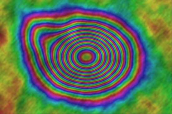
67 SLC scenes; 2,211 candidate pairs reduced to 78 valid interferograms; −35.5 to −2.9 cm/yr, consistent with the peer-reviewed −39.1 cm/yr peak.

Most Earth observation projects lose weeks to finding, downloading, correcting and formatting data. I build the infrastructure that turns that into one command: federated search, verified downloads, processing and cloud-native outputs, all reproducible.
Who need the same data preparation to run identically for every study area and student.
Ingesting imagery from several providers without writing a connector for each.
Moving from folders of GeoTIFFs to catalogued, cloud-native data.
Serving large orthomosaics and indices fast, without a tile server.
One search across 22 verified providers, including Copernicus Data Space, USGS, NASA Earthdata, ASF, Planetary Computer, Element 84, OpenTopography, Planet and Maxar, plus a generic OGC WMS / WFS / WCS connector.
Results are normalised to STAC 1.0 with real footprint geometry and export to GeoJSON, GeoParquet or CSV, so every scene is traceable.
Parallel, resumable, band-selective and checksum-verified downloads, with credentials stored encrypted (Fernet) or in the system keyring.
Atmospheric correction (DOS, Sen2Cor, 6S), cloud masking and filling, reprojection, pan-sharpening, mosaicking, 17 spectral indices, and SAR calibration and despeckling.
Cloud Optimized GeoTIFF, GeoParquet, FlatGeobuf and PMTiles; raster2pm converts very large GeoTIFFs to PMTiles block by block.
YAML pipelines with scheduling and run history; geo-repair and pygeoproof for validation and drift detection; pytest on GitHub Actions with Codecov coverage.
pygeofetch is published on PyPI, CI-tested, documented on Read the Docs and archived on Zenodo (doi:10.5281/zenodo.22087230).
67 SLC scenes; 2,211 candidate pairs reduced to 78 valid interferograms; −35.5 to −2.9 cm/yr, consistent with the peer-reviewed −39.1 cm/yr peak.
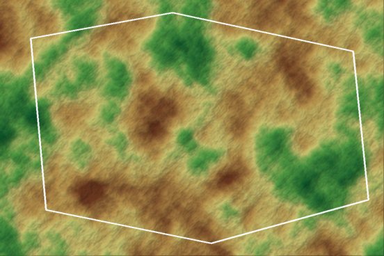
Boundary-clipped USGS Landsat NDVI trend: 32.0% of the district in measurable decline (9.2% strong, 22.8% moderate), concentrated around mining.
Switch between Copernicus, USGS, NASA or commercial imagery without rewriting the pipeline.
Checksums, resumable transfers and a doctor command for install and connectivity diagnostics.
Typed APIs, test suites, CI coverage and documentation, as in any software product.